


A rum time
St Elizabeth’s Nassau Valley is home to the Appleton Estate — the very place where Jamaica’s internationally celebrated rum is distilled, using cane grown on the 11,000-acre property. And a carefully curated distillery tour gives visitors a chance to learn all about the history, technology, and art of rum — and to taste the fiery spirit. In fact, your palate gets to experience every stage of production, from fresh cane juice to molasses to a dozen different rum blends sold under the Appleton label. This is one excursion for which you’ll definitely need a designated driver.
Unhidden treasure
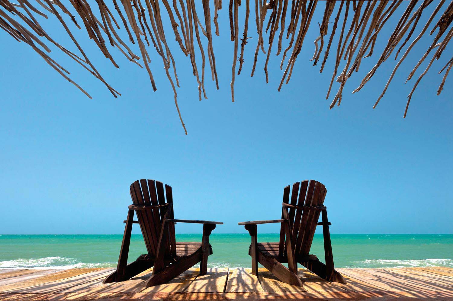
Southeast of Black River, the stretch of coast known as Treasure Beach is probably no longer Jamaica’s best-kept secret — not after it’s been profiled in umpteen travel magazines! — but it remains one of the island’s most genuinely relaxed and almost unspoiled tourism spots. Every other May, Jake’s Hotel is the venue for the Calabash Literary Festival, which draws writers from around the world and crowds of sophisticates from Kingston, but the rest of the time you’re likely to have the beachfront almost to yourself. Private villas, rustic guesthouses, and down-home restaurants are the prevailing fare. For one of the most memorable beverages you’ll ever consume, hire a fishing boat to take you out to the celebrated Pelican Bar, a shack on stilts built on a sandbar half a mile offshore, where the sea view literally surrounds you, 360 degrees.
What’s in a name
Whatever name the indigenous Taíno had for this region of Xaymaca has been lost to history, but it was given the name St Elizabeth in the late
seventeenth century, soon after the British seized the island from the Spanish. The Biblical St Elizabeth was the mother of John the Baptist, but the parish was actually named in honour of the wife of English Governor Sir Thomas Modyford. Once extending all the way to Jamaica’s westernmost point, the parish was divided in 1703, with much of its western portion becoming the parish of Westmoreland.
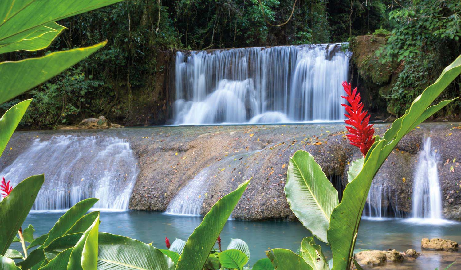
Road trip
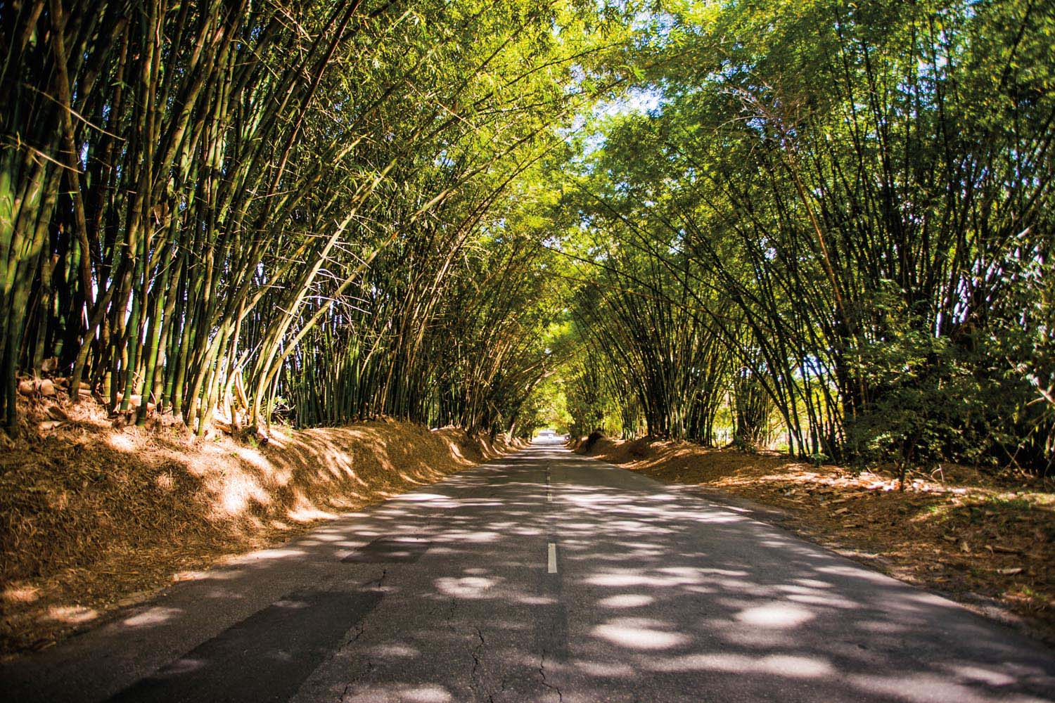
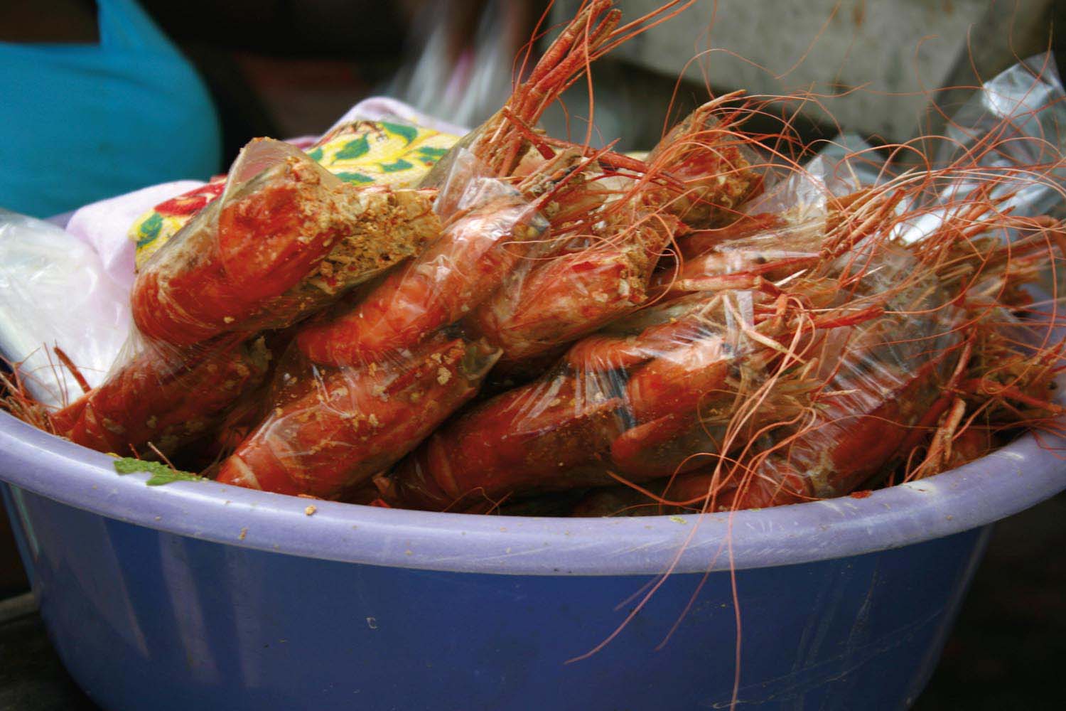
The best way to explore St Elizabeth is by car, and on a very relaxed schedule. Driving north from Black River, you’ll soon come to the village of Middle Quarters, known across Jamaica for the pepper shrimp (below left) — actually highly spiced small crayfish — sold at roadside stalls. Crayfish have been caught in the river here for centuries, using skills brought over from West Africa generations ago. After Middle Quarters, look out for the sign marking the turnoff to YS Falls (below), in the middle of a cattle and horse farm. Seven low cascades alternate with natural swimming pools along the river, with a platform for jumping and rope swinging at the top. Alternatively, take the road towards Lacovia to experience another of
Jamaica’s postcard-photo locations, Bamboo Alley (left) — a two-mile-long stretch of the main road shaded by towering bamboo trees on either side, said to have been originally planted in the seventeenth century to provide shade to travellers.
Topography
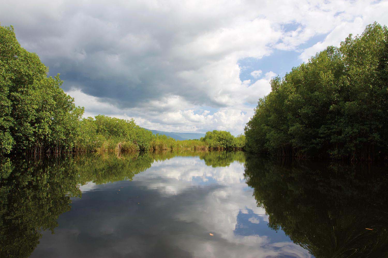
St Elizabeth’s 468 square miles — making it Jamaica’s second-largest parish, by a whisker — range from the mangrove forests of the Black River Great Morass to the rugged slopes of the Santa Cruz Mountains, which bisect a broad plain at the foot of the Cockpit Country. The Black River itself, the island’s broadest, and its associated wetlands, provide a habitat for numerous species of bird, fish, and crustacean, a population of American crocodiles, and even the occasional rare manatee — many of which you can spot on a boat tour. Over a hundred caves have been charted in the limestone areas in the north of the parish, and you can find one of the most dramatic views in Jamaica at Lovers’ Leap, a lookout point on a cliff a sheer 1,700 feet above the sea, site of what’s said to be the highest lighthouse in the Western Hemisphere.
A town with history
Nowadays the town of Black River, at the mouth of the self-same river, has a decidedly sleepy atmosphere, but this was once a bustling boomtown, thanks to its sheltered harbour. Founded sometime prior to 1685 — when it first appeared on a British map — Black River prospered as a port for the export of sugar and the import of enslaved Africans. Farquharson Wharf, the original venue for slave auctions, survives as a reminder of this brutal era. Later, the town’s fortunes floated on the lucrative trade in logwood (sometimes called Jamaica wood) from forests in the interior of the island — exported to Britain to produce dyes. By the end of the nineteenth century, Black River was second only to Kingston as a commercial centre in Jamaica. In 1893, it was the first town in the island to install electricity, and a decade later Jamaica’s first automobile landed here. A handful of Georgian and Victorian townhouses survive from this time, such as Waterloo House and Invercauld House (now a hotel), alongside Victorian brick warehouses.
Coordinates
17.9° to 18.2º N, 77.6° to 78º W
From sea level to 1,229 feet (highest point in the Santa Cruz Mountains)
Caribbean Airlines operates daily flights to Norman Manley International Airport in Kingston and Donald Sangster International Airport in Montego Bay from destinations in the Caribbean and North and South America


