
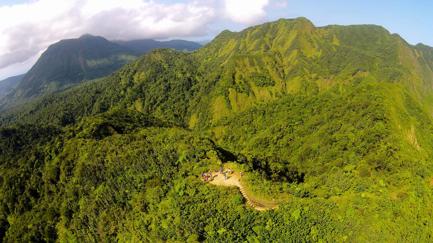
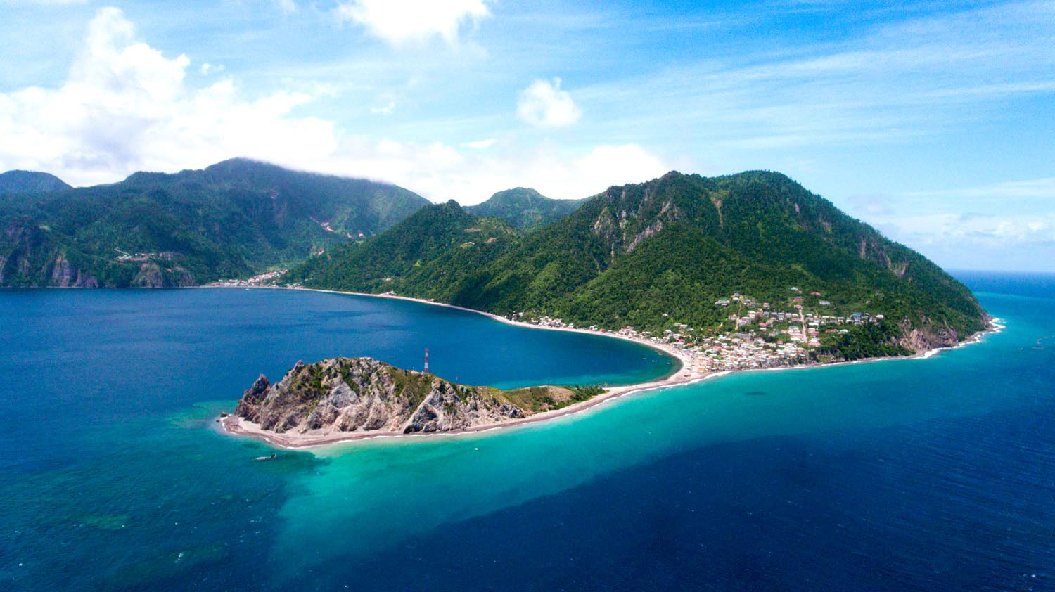


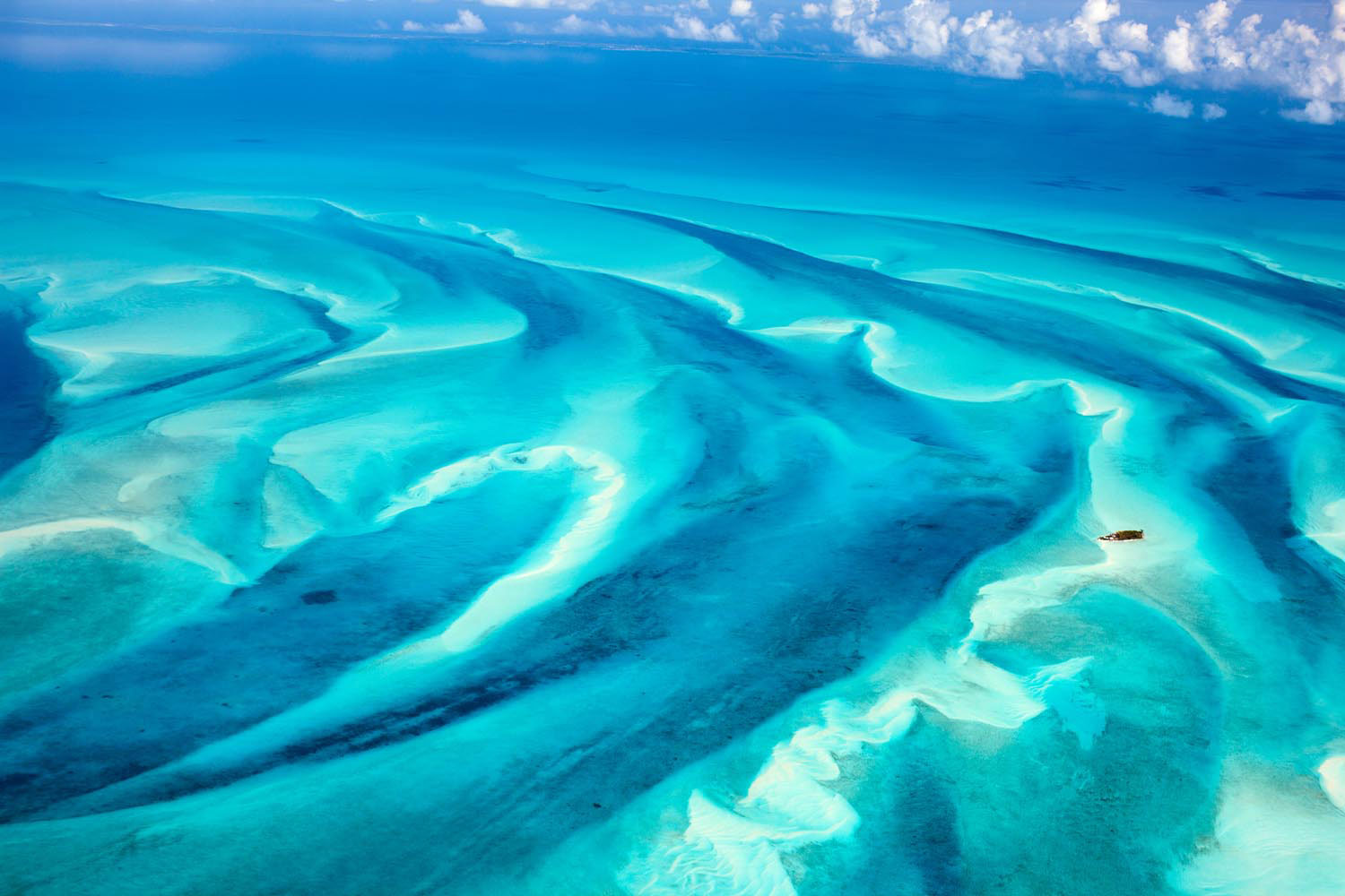


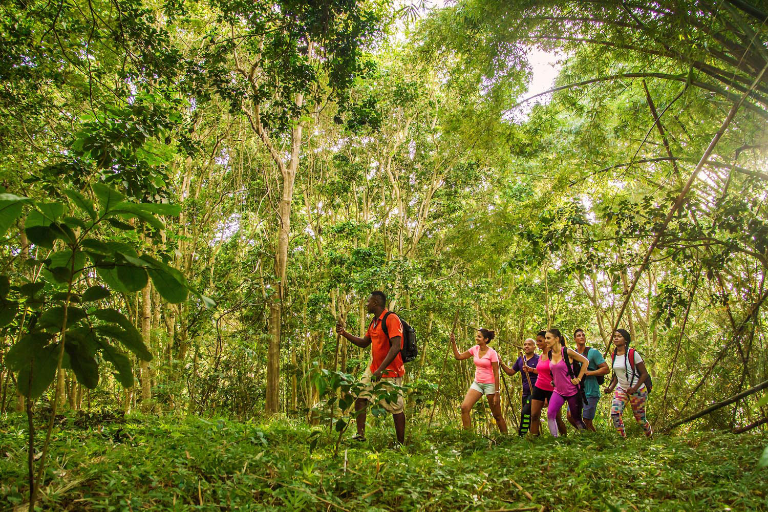


Dominica
290 square miles
Highest point: Morne Diablotins, 4,747 feet
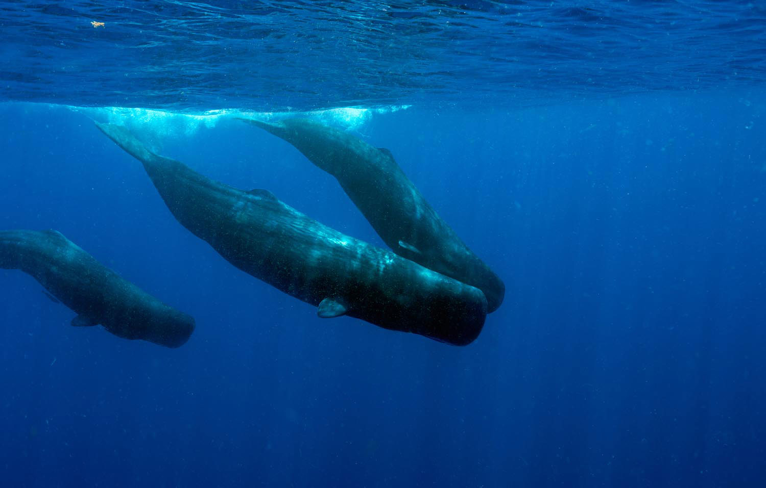
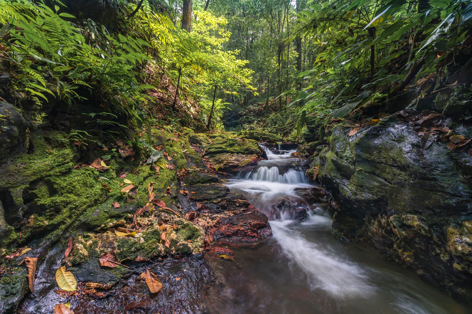
Northernmost of the Windwards, Dominica is famed as the Nature Island — and no place better deserves that nickname. Here are volcanic mountains soaring into the clouds, laced with cold rivers and waterfalls plunging into verdant pools, plus a shoreline of black volcanic beaches, and the Caribbean’s best whale-watching sites. Within easy reach of Roseau, Morne Trois Pitons National Park — a UNESCO World Heritage Site — has a landscape shaped by volcanic activity, including the celebrating Boiling Lake, at the end of a six-mile hike, with its waters geothermally heated to 90 degrees Celsius (don’t fall in). Not far to the west are Middleham Falls, a 250-foot cataract cascading into a mesmerisingly blue pool, deep in the forest. And Dominica’s crown jewel is the Waitukubuli National Trail, at 115 miles long the Caribbean’s longest single hiking trail, bisecting the island from north to south. The route takes a full two weeks to complete end to end — that’s a challenge for your bucket list.
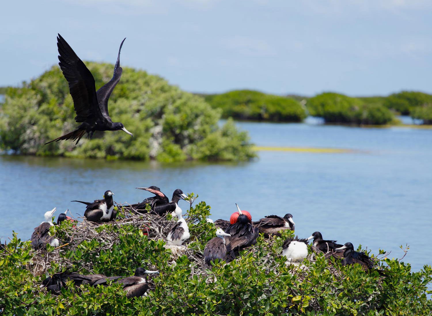
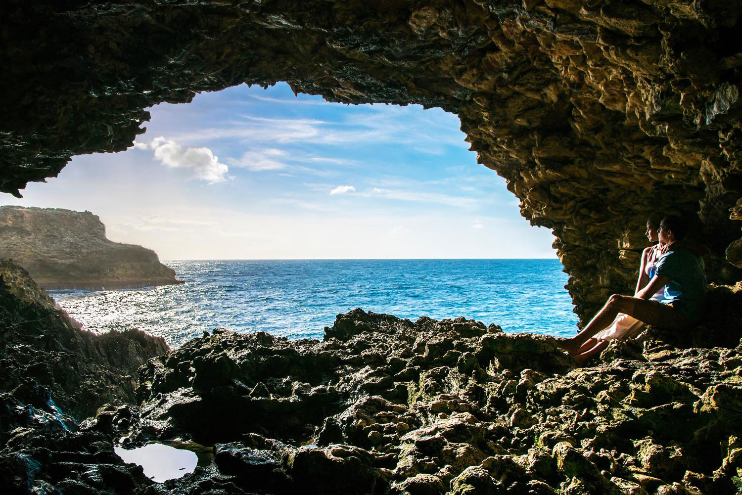
Antigua and Barbuda
170 square miles
Highest point: Boggy Peak, 1,319 feet
A kayak trip is the best way to explore the red mangrove forests of Antigua’s North Sound Marine Park, dotted with islets. Great Bird Island is the only place in the world where you’ll find the rare (and harmless) Antiguan racer snake, whose numbers are gradually increasing. Thirty miles north, Barbuda’s Frigate Bird Sanctuary in Codrington Lagoon boasts the world’s largest population of these impressive seabirds, with an estimated ten thousand birds. And the sea cliff that runs along Barbuda’s eastern shore offers a rugged hike with numerous caves along the route. Look out for the Darby sinkhole, seventy feet deep and three hundred in diameter, containing a small forest of palm trees and ferns, home to wild deer. Two miles away, Dark Cave contains a vast underground pond, home to tiny translucent blind shrimp, adapted to the almost total absence of light.
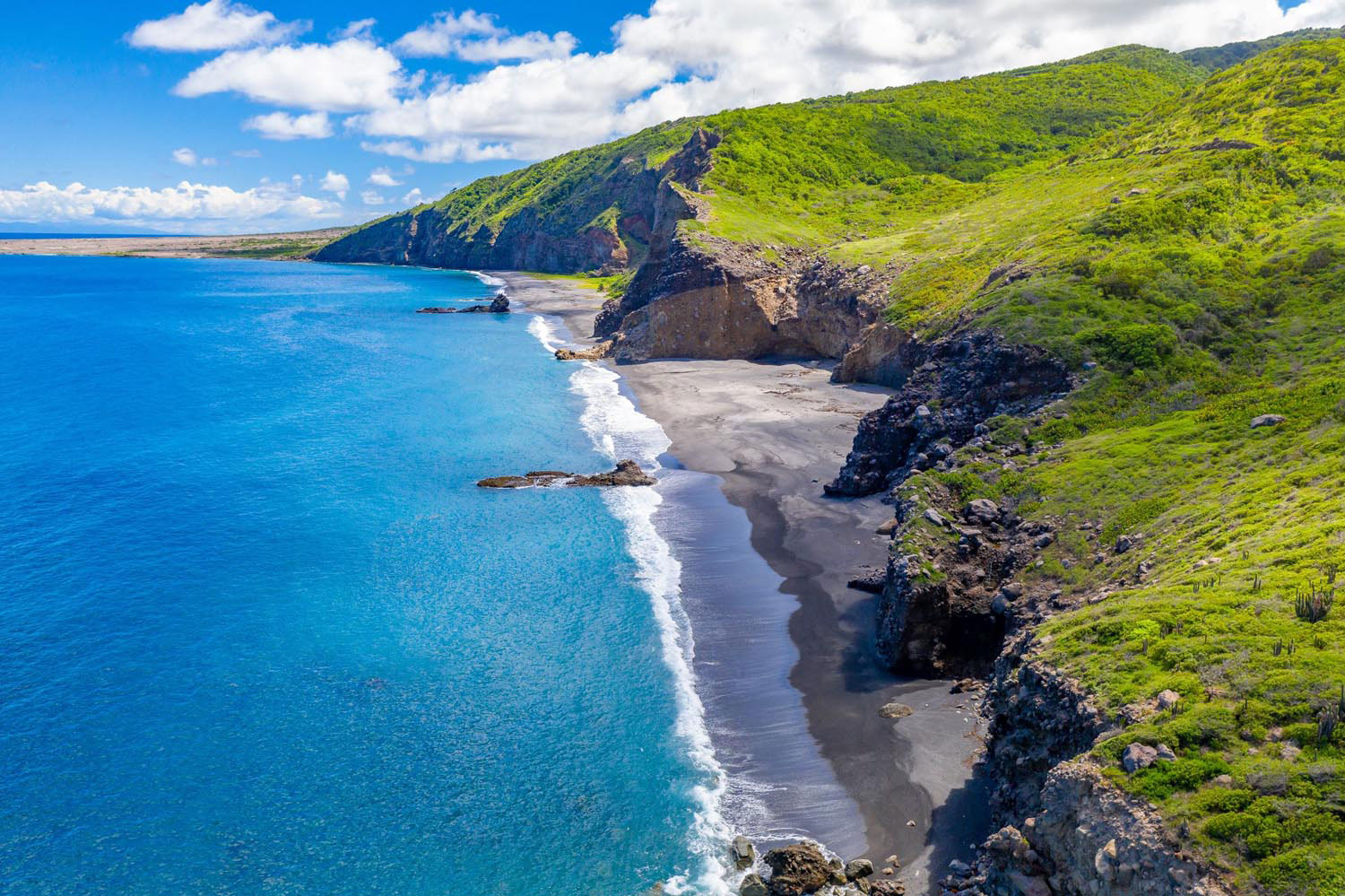
Montserrat
39 square miles
Highest point: traditionally recognised as Chances Peak, 3,002 feet, but ongoing volcanic activity in the Soufrière Hills has created a dome estimated to be 3,051 feet above sea level
It’s impossible to overlook the relentless power of nature in Montserrat, the Caribbean’s Emerald Isle. In 1995 the Soufrière Hills Volcano, long thought dormant, woke with a bang. A series of eruptions covered vast tracts of southern Montserrat with a thick layer of volcanic ash, rendering nearly two thirds of the tiny island uninhabitable. Yet, a quarter-century later, Montserrat is once again a jewel for visitors, with one of the region’s friendliest populations, untouched beaches, incredible dive sites — and a wealth of nature, easily accessible from the new capital at Brades. The forested slopes of the Centre Hills and Silver Hill are woven through with hiking trails, on which the National Trust organises regular excursions. Try to spot the rare Montserrat oriole, the national bird, found nowhere else in the world — there’s even an Oriole Walkway Trail. And for an unforgettable lesson in geology, you can join a tour — conditions permitting, and always putting safety first — into the exclusion zone with a certified guide, for a dramatic close-up view of the volcanic forces that created the island.
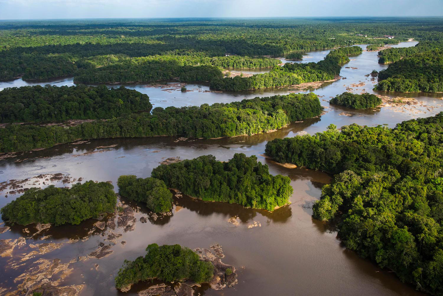
Guyana
83,000 square miles
Highest point: Mt Roraima, 9,301 feet
Where to start with Guyana, the Caribbean region’s eco-tourism treasure? Maybe with the Pakaraimas near the border with Venezuela, dramatic table mountains surrounded by remote valleys, the source of some of Guyana’s mightiest rivers. Or with vast Shell Beach on the Pomeroon coast, nesting site for endangered sea turtles. Or with the Iwokrama rainforest along the Essequibo, a protected wilderness that’s home to jaguars and tapirs and hundreds more species. The best way to experience wild Guyana is through community-run lodges in Amerindian villages across the Rupununi Savannah, from Surama to Nappi, Annai to Karasabai, each offering rustic hospitality, proximity to amazing scenery and wildlife, and a chance to explore landscapes unlike anything in the insular Caribbean. And even if you can’t spare more than a day, an hour-long flight from Georgetown will get you to Kaieteur Falls — they may look spectacular in photos, but nothing compares to the real thing.
Jamaica
4,240 square miles
Highest point: Blue Mountain Peak, 7,402 feet
To explore wild Jamaica, you can start on the very outskirts of Kingston, where the dramatic Blue Mountains — famous for their coffee — form a towering backdrop. A hike to the higher elevations offers majestic views across the valleys as you ascend to cloud forest. To scale Blue Mountain Peak itself, you traditionally camp near the trailhead and set off in the wee hours, to catch the sunrise at the summit — some say that in the clearest weather you can even see Cuba to the north. Heading east from Kingston, Jamaica is dominated by its hills, whether rolling gently or plunging abruptly. The island’s most biologically diverse region is also one of its least known: the five hundred square miles of the Cockpit Country, south of Montego Bay. Imagine a landscape dotted with thousands of limestone sinkholes — the “cockpits” — thickly forested and home to rare species. For centuries, this was the stronghold of Jamaica’s Maroons, and a guided trek is one of the island’s biggest outdoor adventures.
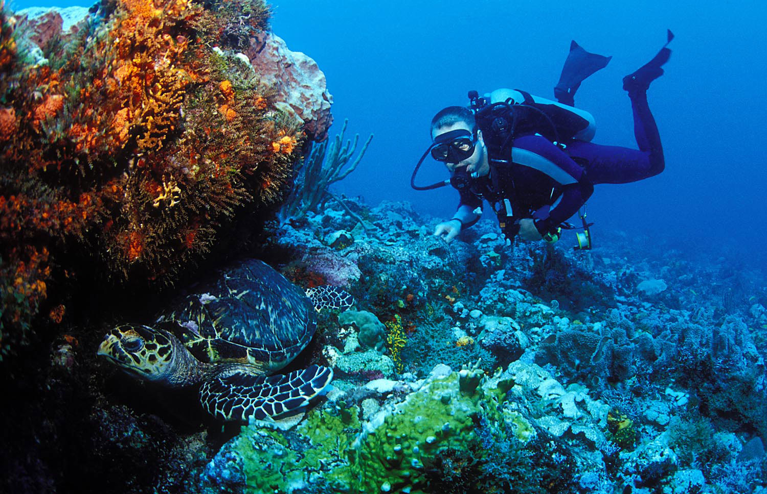
Cayman Islands
102 square miles
Highest point: The Bluff, 141 feet
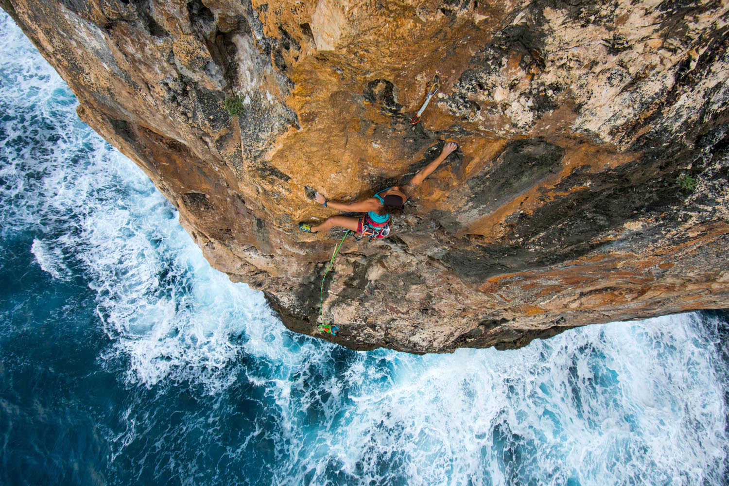
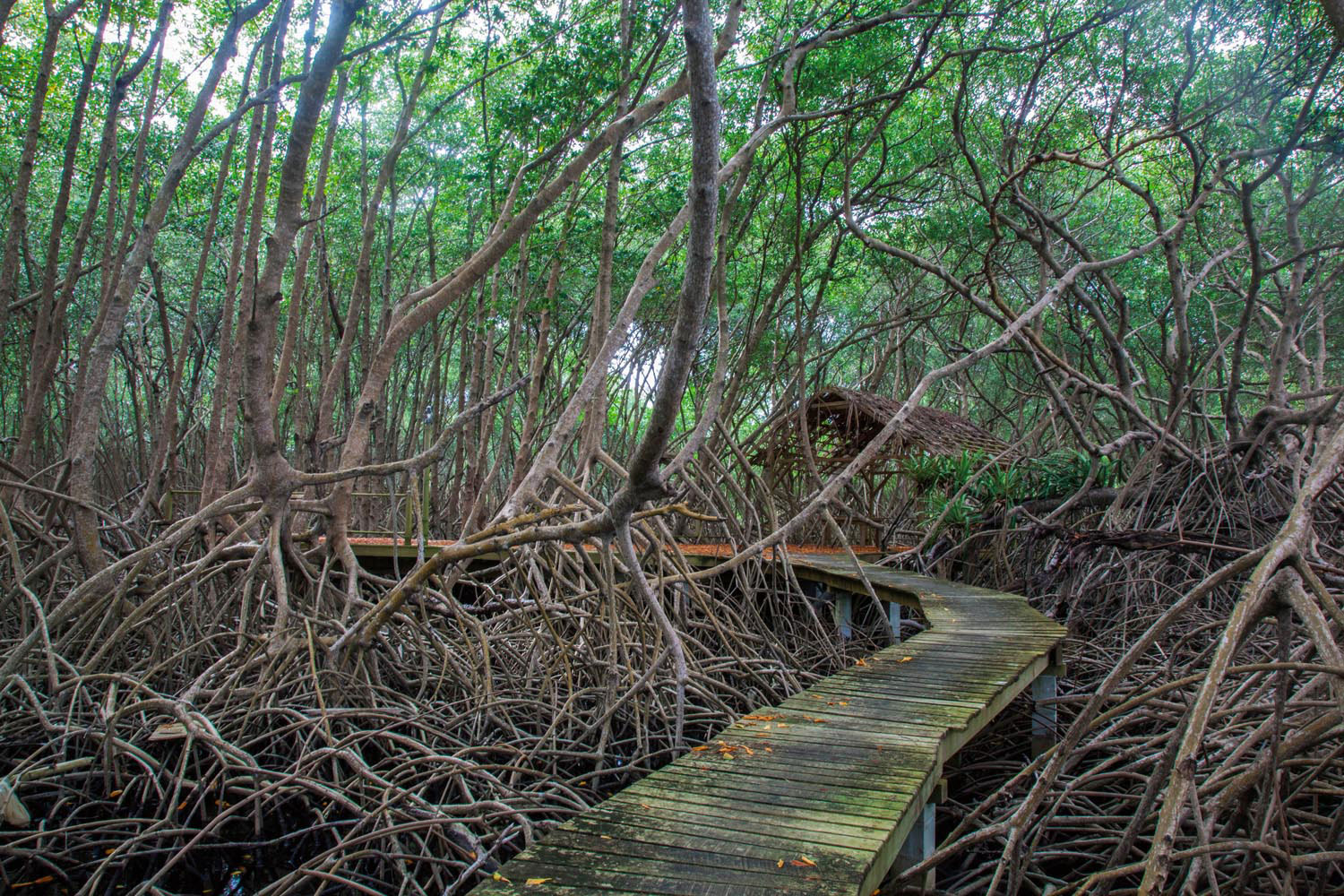
The Cayman Islands’ most awesome natural features are actually below the sea. There’s a reason this is one of the world’s most coveted diving and snorkelling sites. The most dramatic spot of all may be Bloody Bay in Little Cayman, where a sheer submarine wall begins at a depth of twenty feet, plunging a full mile down. Swimming out over the drop-off is an unforgettable experience. Grand Cayman is also surrounded by first-class dive sites: walls, caves, crevices, all teeming with fish and other species. If you prefer to stay dry, try your skill on a different kind of wall, rock-climbing on some of the Caymans’ vertiginous shoreline cliffs. The most popular sites have been outfitted with non-rusting titanium bolts for safety. For a less intense workout, explore Grand Cayman’s Mastic Trail, which takes you from mangrove forest through stands of silver-thatch and royal palms.
Cuba
42,426 square miles
Highest point: Pico Turquino, 6,476 feet
Nearly a quarter of the Caribbean’s largest island is protected in preserves and sanctuaries, including ten national parks — it would take months to properly explore them all, from the bird-filled wetlands of Cienaga de Zapata (with a million protected acres) to the sea turtle nesting sites of Guanahacabibes at Cuba’s western end. Hoping to spot the extremely rare and secretive Cuban solenodon, a nocturnal mammal that hasn’t been seen in the wild since 2003? Sierra Cristal, the country’s oldest national park, is the place to try your luck. Rock climbers head to Viñales National Park, to tackle its sheer limestone cliffs. For scuba divers, the number one spot is Jardines de La Reina National Park, an archipelago of reef-fringed islands off the south coast. But the loudest call of the wild may come from the Cuchillas del Toa at Cuba’s easternmost tip. This biosphere reserve protects dense rainforest, the table mountain known as El Yunque, and the three-hundred-foot waterfall Salto Fino — tallest in the Caribbean archipelago.
St Vincent and the Grenadines
150 square miles
Highest point: La Soufrière, 4,049 feet
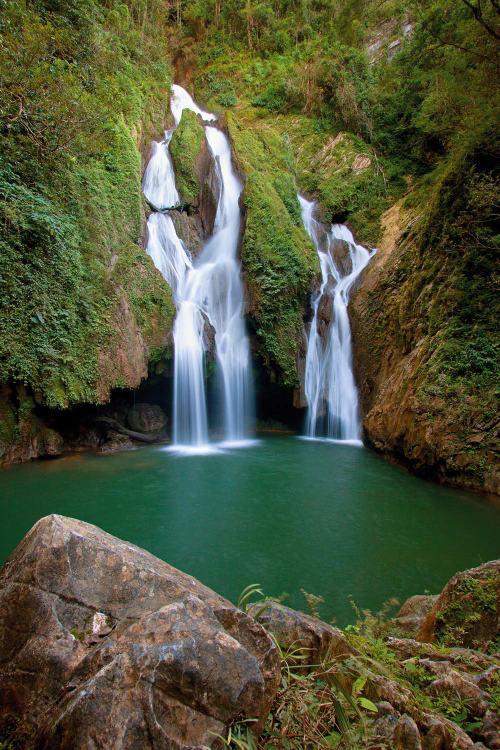
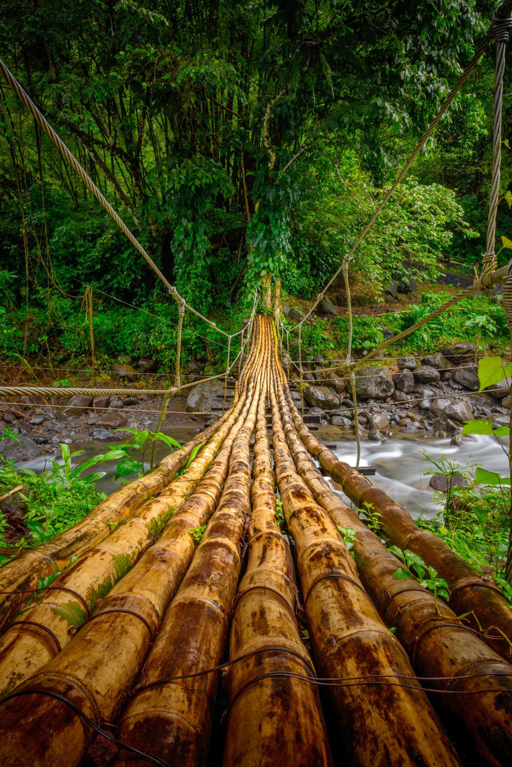
Dominating the northern end of St Vincent, volcano La Soufrière last erupted in 1979, but in recent decades it’s kept quiet. And a hike to its crater rim must be the number-one eco-adventure on the island, with two alternate routes and the payoff of a once-in-a-lifetime view. Rugged volcanic terrain is the island’s signature. You can see it in the craggy lava formations around the Owia Salt Pond, where natural tidal pools are sheltered from Atlantic breakers, and in the waterfalls of the interior valleys, like the double cascade of Dark View Falls, reached by crossing a bamboo bridge, or the triple cataracts of Trinity Falls. You can find an easier but no less rewarding hike at Vermont Nature Trail, where a guided tour introduces you to the island’s lush flora, plus a chance to glimpse the rare St Vincent parrot in its wild habitat. South of the main island, the Grenadine archipelago is renowned for its seascapes — most unforgettably, perhaps, in the Tobago Cays.
Trinidad
1,814 square miles
Highest point: El Cerro del Aripo, 3,084 feet
Just nine miles off the coast of Venezuela, Trinidad is a piece of South America that broke off a few thousand years ago, and the island’s Northern Range is geologically the final spur of the Andes, disappearing into the Atlantic at Point Galera. Still largely covered with rainforest, those mountains are just one of Trinidad’s distinct ecosystems, which also include the Caroni and Nariva Swamps, natural savannahs in the central plains, and rugged offshore islets. This is a birdwatcher’s paradise, with 469 species counted on the island — one of the few places in the world with such a concentration in such a small area. But there’s much more: the eerie mud volcanoes of Devil’s Woodyard, the world-famous Pitch Lake, gorgeous north coast bays accessible only by boat or hiking on forest trails, and the Mt Tamana caves, home to vast colonies of bats.
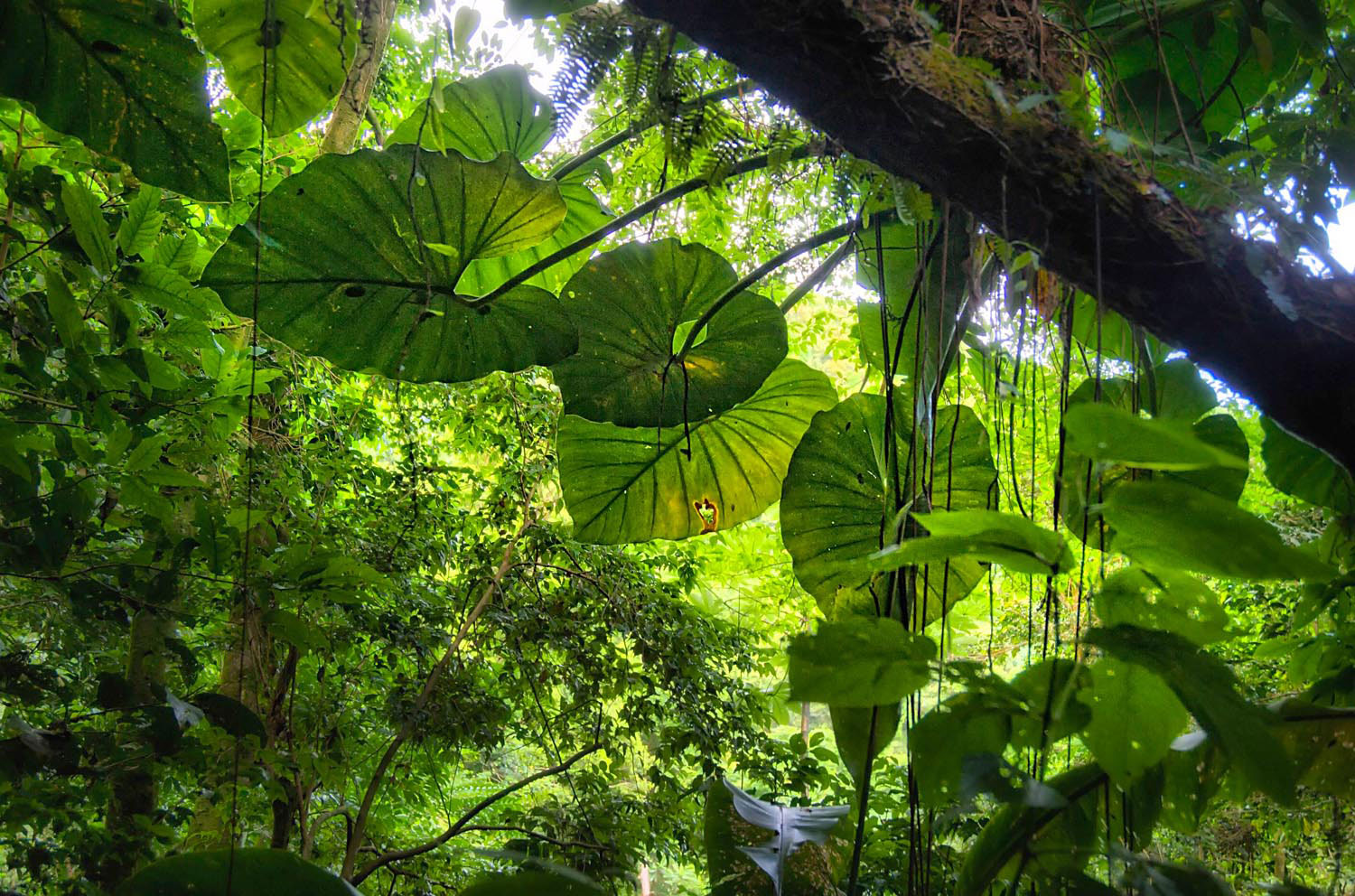
Suriname
63,250 square miles
Highest point: Julianatop, 4,199 feet
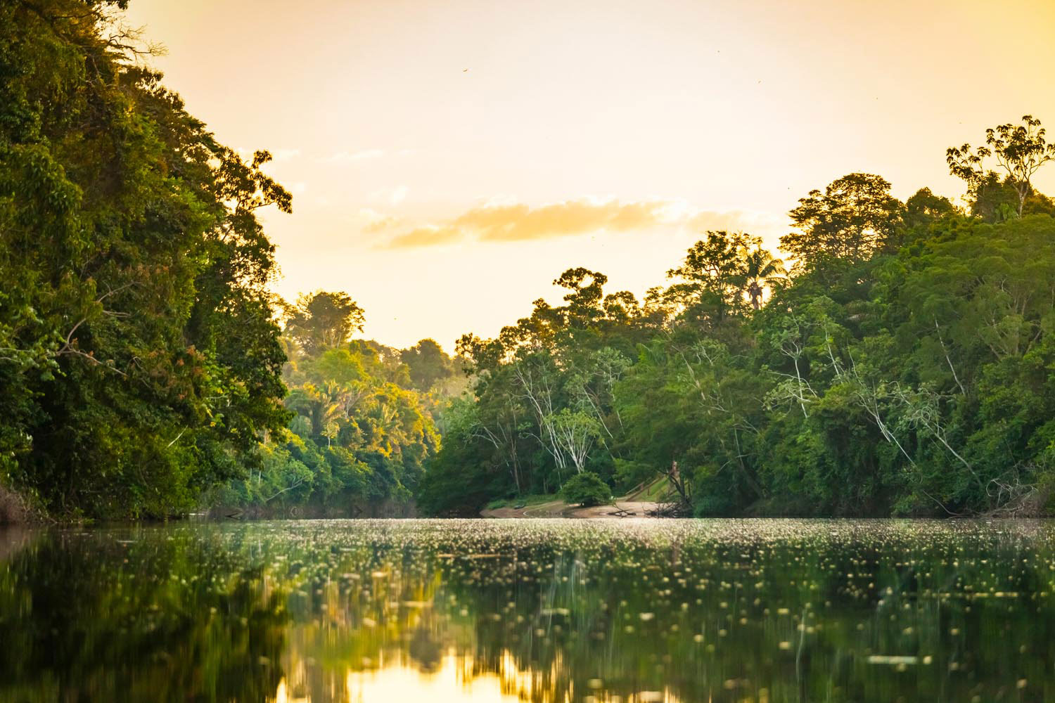
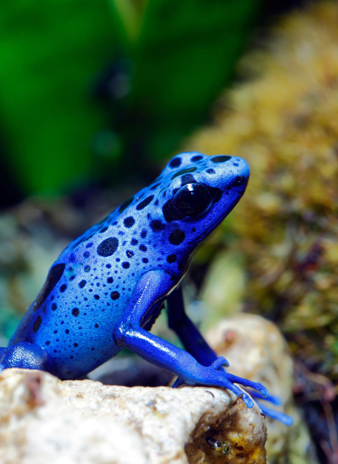
Scattered across the remote interior, Suriname’s rainforest lodges — many of them accessible only by plane — take you right to the heart of the country’s wild, pristine beauty. Some are perched on mountaintops, others beside winding rivers of cola-brown water, stained by fallen leaves. Birds and monkeys cry in the near distance, insects whir constantly, and oxygen pumped out by the rainforest fills your lungs. The biggest jewel in the crown is the Central Suriname Nature Reserve, a UNESCO World Heritage Site covering nearly a tenth of the country, with habitats ranging from Amazonian rainforest to rocky savannahs and granite table mountains: the place to spot such eye-catching creatures as the vermilion cock-of-the-rock or the famous blue poison dart frog. If you can tear yourself away from the forest, Suriname’s coast also waits to be explored: like the nature reserve at Galibi and Matapica Beach, both sea turtle nesting sites on the Atlantic.
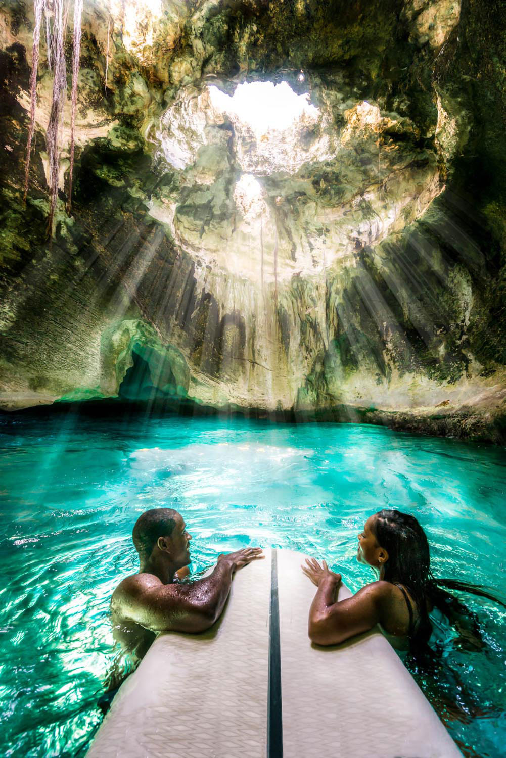
The Bahamas
5,358 square miles
Highest point: Mt Alvernia, 206 feet
The Bahamas is most famous for sparkling beaches and warm, shallow sea, but don’t overlook the other outdoor adventures scattered across these seven hundred islands. At Lucayan National Park in Grand Bahama you’ll find six different natural ecosystems in just forty acres, including one of the world’s largest underwater cave systems, with six miles of charted tunnels. For a glimpse of the islands’ natural vegetation, head to the Primeval Forest National Park in New Providence, where boardwalks and bridges traverse limestone sinkholes and stands of old-growth hardwood trees — or to the Leon Levy Native Plant Preserve in Eleuthera, where you can also learn how local flora are traditionally used in bush medicine. And Andros is the Bahamas’ eco-tourism hotspot. Here you’ll find the world’s third-longest barrier reef, over 124 miles long.
Grenada
135 square miles
Highest point: Mt St Catherine, 2,757 feet
There’s a tale that Grand Etang, the crater lake perched high in the centre of Grenada, is bottomless. It’s not true, of course, but the hiking in the national park around the placid lake is worthy of legend, especially the trail to the summit of Mt Qua Qua — a six-mile round trip through elfin cloud forest, with a 360-degree view across the island from the summit. For birders, La Sagesse on the south coast is obligatory. This mangrove estuary with a nearby small salt pond and thorny scrub forest offers enough habitat diversity to attract one of the island’s most impressive concentrations of birdlife, especially waterfowl. At Grenada’s opposite end, Levera Beach is remote, windswept, wildly beautiful, and a major nesting site for endangered leatherback turtles, who come ashore at night during the annual nesting season (from March to August) to laboriously excavate the pits where they lay their eggs.
Barbados
166 square miles
Highest point: Mt Hillaby, 1,102 feet
Twenty-one miles long by fourteen wide, Barbados is a coral outcropping east of the Antillean chain, and this geology creates a distinctive limestone landscape. There’s no better place to explore it than Harrison’s Cave, an extensive subterranean system of caverns and tunnels, festooned with bizarre limestone formations. Known for hundreds of years, the cave system was surveyed only in the 1970s, and developed as a tourist attraction. An electric tram takes you deep into the earth past waterfalls and pools, for a drive-through spelunking experience. Geological history comes to the surface along the island’s east coast, where the rolling hills of the Scotland District fall abruptly into the Atlantic, met by waves that have travelled thousands of miles across the ocean. Mushroom-shaped rock stacks are carved by constant erosion, and wave conditions make Bathsheba a magnet for surfers. For a glimpse at Barbados’s original vegetation, visit Welchman Hall Gully with its linear expanse of tropical forest — this is what almost all of Barbados looked like once.
Tobago
116 square miles
Highest point: Pigeon Peak, 1,804 feet
Since 1764, the forests of Tobago’s Main Ridge, running the length of the island, have been a protected reserve — the oldest in the Caribbean. In these hills and valleys you’ll find winding roads, quiet trails perfect for hiking and mountain biking, rushing streams, and dozens of waterfalls — some of them celebrated and easily accessible, like Argyle Falls, others hidden away and known only to local guides. If you’re looking for a panoramic challenge, try the hike up Pigeon Peak, near Charlotteville, where you’ll likely have the trail to yourself — unless you count the birds trilling and chattering in the trees above and around you. Or for an easier excursion with a swim at the end of it, head to No Man’s Land, a stretch of uninhabited coast near mangrove-fringed Bon Accord Lagoon, an important wetland habitat. Tobago’s natural splendour extends below the surface, too — with world-class diving sites around the island, teeming with life nourished by the Orinoco outflow.
Curaçao
171 square miles
Highest point: Christoffelberg, 1,220 feet
At Curaçao’s northwestern tip, Christoffelpark — named for the mountain at its heart — is both a reserve for the island’s most biodiverse region, and the setting for outdoor adventures on its rocky trails traversing the distinctive thorny divi-divi forest. Look out for thickets of towering cactus and rare orchids like the Lady-of-the-Night, with its delicate fragrance. Orioles and hummingbirds lend flashes of colour, wild deer and rabbits scamper away, and you can’t avoid spotting one of Curaçao’s ubiquitous iguanas. As you climb Christoffelberg, clambering past huge boulders, views open up across the surrounding valleys to the shimmering sea. Nearby Shete Boka National Park — the name is Papiamentu for “seven inlets” — covers six miles of coast, from jagged limestone cliffs and arches to tiny coves where sea turtles nest. Don’t miss Boka Tabla, where waves crash spectacularly into an underground cavern, reminding you of the sheer power of the sea.
St Lucia
238 square miles
Highest point: Morne Gimie, 3,143 feet
The charming small town of Soufrière on St Lucia’s southwest coast is the gateway to the most picturesque part of the island. To start with, there are the Pitons: two volcanic plugs rising abruptly from the shore, lush forest clinging to their slopes and crevices. Gros Piton, the taller of the two, is the easier to climb, with a challenging but rewarding trail — a four-hour round trip, with St Lucia’s most incredible views at the summit. Not far inland are the Sulphur Springs, in the remains of an ancient volcanic crater. After a day’s hiking, when your muscles are sore, make your way to Diamond Gardens, where pleasantly landscaped grounds lead to outdoor baths with geothermally heated and mineral-rich water from the Diamond River. The most rugged side of St Lucia is the Atlantic coast, a stretch of small bays with crashing waves, and forested hills descending in cliffs. The Maria Islands off the southeast, accessible by boat, are a protected nature reserve, home to St Lucia’s rare endemic snake and lizard — the latter coincidentally sharing the blue, black and yellow of the national flag.


